Hiking in Trollheimen, Norway
In 2021, I went solo hiking in Trollheimen in Norway. Here I describe my adventures and do a short analysis of the used equipment.
Planning a trip in the Corona time could be adventurous, although stupid. I booked the tickets for my trip to Trollheimen in spring 2020. Like everyone, I was naive, expecting life would return to normal after the first lockdown. In summer 2020, the pandemic was indeed on the decline. Then it hit everybody like a hammer again. The number of cases started to grow, and Norway decided to introduce a quarantine for all the Dutch residents just a couple of days before my trip. What a loser! Instead of enjoying views of Innerdalen, “the most beautiful valley in Norway,” and the boreal landscapes of Tyrikvamfjellet, I was coping with depression while walking along the beaches in The Hague.
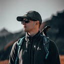
Next August 2021, I was luckier. Norway allowed entrance for the vaccinated travelers, and I fulfilled my dream of doing solo hiking in the mountains of Trollheimen.
My travel started in Trondheim — the old capital of Norway. A scenic seaside city with many historical locations and hipster snack bars. The next day after arrival, being a transport geek, I took a journey by the most northern tram line in the world to Bymarka park, where I had a short “warming up” hike.

The next day: a morning train to Oppdal, a short bus tour, and 10 km walking to Gjevilvasshytta. A place where the famous Trollheimen triangle hiking route starts that connects the three lodges: Gjevilvasshytta, Jøldalshytta, and Trollheimshytta. My initial plan was to complete this route.
Day 1: Gjevilvasshytta — Jøldalshytta
Distance: 34.2km, Time: 11h, Elevation gain: 594m
To avoid wasting time, I started the route on the same afternoon. The beginning was a muddy trail up the mountains. It was completely different from walking in the Alpine meadows somewhere in Tyrol, where you can wear a pair of sneakers. My boots soon became wet, and all the rare hikers I encountered complained about the mud and rawness.
At some point, the mud passed, and the trail continued through a tundra-like bald area that reminded me of the polar north. When it started to get dark, I put the tent near a reindeer herders camp while fighting the extreme wind. The first hiking day was over.
Day 2: Jøldalshytta — Trollheimshytta
Distance: 29.2km, Time: ~13hr, Elevation gain: 1053m
There are three routes between Jøldalshytta and Trollheimshytta: mountains via Geithetta, swamps via Svartådalen, and mountains via Trollhetta. The third one is the longest, but it passes three summits of Trollhetta from which you can see the beautiful views of the valley of Svartådalen. So that was my choice.
The day started with rain, and low clouds in the sky were the sign the beautiful views would not be available. Seeking a challenge, I decided to follow the chosen route anyway. And there was no problem finding a challenge at all. The rain became more brutal. At some point, the rain combined with snow and wind gusts. Finally, the mountains became covered with fog ruining the last hope of enjoying the panorama of the valley. After several hours of semi-walking and semi-climbing on the wet slippery rocks, I reached the main summit, and the rain with wind stopped. It looked like the mountain trolls initially did not want to see me as a guest but changed their minds afterward.
Approaching Trollheimshytta, I had easy and relaxing hiking in a pine forest. All the troubles seemed to be over, which was a naive assumption. The bridges on the way were destroyed, and I had to pass the river by ford. The next challenge was crossing an unmarked bog afterward. I got the impression the trail was abandoned here and not maintained for a long time. To conclude the day, I ignored excellent tent spots near Trollheimshytta, hoping to find something else on the route later. Later, there was a large wetland, and I had to organize my bivouac on a wet grass island surrounded by a marsh.

Day 3: Trollheimshytta — Kårvatn
Distance: 28.8 km, Time: 12hr 21min, Elevation gain: 381m

I was advancing in schedule and still had four days of hiking. Therefore, I decided to take a long hike via the Innerdalen valley instead of completing the triangle route. The new way continued through wetlands, which means water was everywhere. I stopped caring about how dry my boots were very soon. It was unavoidable to protect them against being wet since the trail was flooded all along the way. In addition, I had to cross plenty of streams and small rivers, and of course, the rain didn’t plan to stop. Being completely soaked and exhausted, I was happy to find a hut on the midway. Having a warm lunch with hot coffee while fully protected against the weather gave me some energy. In the evening, I passed the hut in Kårvatn and found a spot for a bivouac shortly after. The tent, the sleeping bag, and most of my clothes were pretty wet.

Day 4: Kårvatn — Innerdalen
Distance: 27.9km, Time: 10hr 40 min, Elevation gain: N/A
The day started with a miracle. The rain stopped! I packed my drenched camping equipment and continued walking the trail, which began to lead uphill. Eventually, the wetland was replaced by a rocky area, and I climbed to the Bjøråskaret passage. The view from here worthed all the troubles in the marches before. The pyramidal mountain Innerdalstårnet, the waterfalls from the rocks, and the gorge of the Innerdalen valley reminded me of scenes from the fantasy movies.

In Innerdalen, I asked the hut owner for his recommendation for the next place for camping. Then I moved along the valley, which was partially flooded and soon it became a hardly-passable bog. The trail finally started to lead up to the mountains, and hiking uphill, even with a 20-kilo backpack, was a relief after the wetlands. The recommended camping spot was at the trail’s highest point, next to a small lake with a stunning valley view. Finally, I got a dry place for a night and a proper spot for hiking Instagram pictures :)

Day 5: Innerdalen — Storlidalen
Distance: 18.8km, Time: 5hr 53min, Elevation gain: 111m
The last day of hiking was also the most leisurely one. Only 10 kilometers left before the final destination. So I woke up without alarm for the first time during the trip and then had a slow cozy breakfast enjoying the scenery. After one hour of hiking down the mountains, I had a coffee break combined with swimming. There was no rain, and the weather was sunny. In other words, that was the only day of wandering a normal person would enjoy.
After arrival in Storli, I found a guesthouse in the village. The owners, Marit and Marius, were extremely hospitable. The next day, they gave me a ride to the closest bus stop with operable public transport. Then I took a local bus and train back to Trondheim. The last parts of the trip were enjoying craft beer in the evening and exploring the city the day after.

My first adventure with multi-day solo hiking was over. It was a valuable experience from a learning perspective about hiking and living outdoor. But most importantly, I got confidence that I was capable of adventures where you can rely only on yourself. When you must walk fast and rub through harsh weather. It opened me to new horizons for exploring the world and better understanding yourself. Concluding, I will surely go on a similar trip the following year, but being more prepared and less reckless.
Retrospective
Equipment worked well:
- Bo-Camp aluminum Moka pot — nothing motivated me more than a cup of strong hot coffee.
- Sea to Summit Latitude LT1 sleeping Bag — kept me warm even after being partially wet.
- Garmin eTrex 32x GPS navigator — was crucially valuable in the places where the trail wasn’t marked (e.g., the broken bridges near Trollheimshytta).
- Rab Electron Pro down jacket — extremely light and compact yet super-warm.
- Osprey foldable backpack — an excellent solution when you can leave a big rucksack in a hotel, but you still need a small bag. I used it for the walks in Trondheim and as hand luggage during the flights.
- Garbage bag — at some point, the backpack became wet inside, but a 60L bag helped save my stuff from being completely soaked.
- Arc’teryx Zeta SL pants — an ultralight hardshell pants for cases when the weather is annoyingly nasty. If you hike in Northern Europe, keep them on the top of a backpack!
Equipment worked okayish:
- Exped Thunder 70L rucksack — an excellent ratio of weight per volume. However, I still don’t get how to adjust the bag for maximum comfort. For instance, I’m not a skinny guy, but the hips belt is a bit too wide even when it’s fully caught in.
- Water bladder aka Camelbak — it’s much lighter than bottles yet more spacious. But it can quickly turn your hike into a disaster by being prone to punching and leaking. It didn’t happen, but I got paranoid and anxious because it was hard to position the bladder in the backpack while avoiding sharp items.
- Anker PowerPort solar panel — I took it just for an experiment. Surprisingly, it charged the phone much faster than I expected, even during the cloudy weather. However, for 5 days of hiking, a power bank would be a better solution from the weight perspective (and, of course, less dependent on weather conditions).
- Therm-a-Rest Trail Pro self-inflating mattress — comfortable and reliable. But it’s also cumbersome for solo hikes when you have to carry all the camping equipment.
Equipment I won’t use anymore:
- Vango Blade 200 tent — you should be very careful with positioning this tent because its unstable construction cannot resist lateral wind. Besides, its single pole is also a single point of failure. On the last day of hiking, the pole broke. I was kind of lucky I wouldn’t need the tent anymore.
- BlackFox 440A G10 folding knife — got broken on its first trip, nuff said.
- Cotton socks — I’m a bit reckless when it goes to socks. It’s hard for me to get blisters, thanks to my youth when my favorite footwear was army boots. Nevertheless, the fact the socks scuffed up and got holes due to moisture didn’t contribute to the enjoyment of hiking.
- Carbon tracking poles from Aliexpress — both poles didn’t survive the trip. A bit of force if a pole got stuck in rocks or mud was enough to break it. But to be honest, I’m not sure if it’s a common problem for carbon tracking poles or a characteristic only for the cheap ones.
Equipment would work:
- Waterproof bags — my rucksack got a leak at some point despite being covered by a rain cover. I would sleep in a dry, warm tent if the stuff inside was packed in waterproof bags.
- More appropriate socks for wet climates — for example, could be wool socks that keep warm even when soaked.
Lessons learned
- If you see a good place for a tent in the evening, just take it. It’s better to make a couple of kilometers less during a day than to desperately search for an appropriate camping place in an area that completely sucks.
- When it’s two days of non-stop rain, even waterproof equipment cannot guarantee to keep your items dry. Therefore, you need to rely on several layers of water protection and be prepared that all your stuff can get soaked.
- If you do hiking in open places, be sure your tent has a high level of resistance against wind.